


 Canyon the only tourist canyon in the Fagaras Mountains")


 – Apuseni mountains")

 – deepest cave in Romania")


 Castle from Hunedoara")


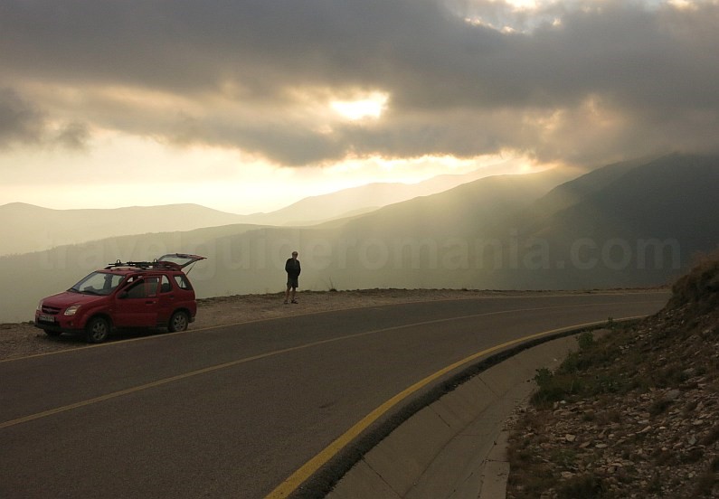
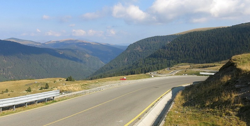
The Transalpina (DN 67C) is the highest road in Romania, crossing the Parâng Mountains over the Urdele Pass (at 2,145 m). Transalpina connects Transylvania and Oltenia between the villages Novaci in Gorj County and Sebeș/Săliște in Alba County. In recent years it has become one of the most sought after destinations in Romania, along with Transfăgărășan, by drivers, motorcyclists and cyclists as well.
Transalpina has a length of:
– 148 km from Bengești (the place where it begins from DN67 Tg.Jiu-Rm.Valcea) to Sebeș (junction with DN1 Sibiu-Sebeș)
– respectively 155 km from Bengești to Săliște (junction with DN1 Sibiu – Sebeș) – this is the original route of Transalpina.
On different sections the road has:
Sebeș-Șugag: 27 Km; Şugag – Obârșia Lotrului: 60 Km; Obârșia Lotrului-Rânca: 30 Km; Rânca-Novaci: 18 Km; Novaci-Bengești 13 Km.
Data on the construction of Transalpina
Transalpina was originally a mountain trail, known as the “Devil’s Trail”. The trail was used by shepherds from Sibiu to cross the mountains with herds of sheep in Wallachia. This transhumance road connected Transylvania to Oltenia.
Between 1934 and 1939 the road was rebuilt at the disposal of King Carol II of Romania. He wanted a strategic road that could be travelled by troops passing from / to Wallachia in Transylvania. The road was opened in 1939 by King Carol II himself, at the wheel of an off-road. The original route of Transalpina, as it was inaugurated by King Carol II, was from Novaci (Gorj) to Săliște (Sibiu). Since then it has been known as the King’s Road, which replaced the popular name of the “Devil’s Trail”.
The road was not looked after until 2009, when modernization works began on the portion Rânca (1,600 m) – Lake Oașa. The official opening on the portion between Rânca and Obârșia Lotrului was in 2015. The road still requires rehabilitation on short portions, less than 1km of asphalt, on the portion of Lake Oașa – Obârșia Lotrului. Transalpina also presents areas where not all parapets are mounted.

The most spectacular altitude area of about 25 km between Rânca (Gorj) and the Oaşa Dam (Alba) is closed during winter. The date of road opening/closing differs from year to year, depending on the weather, as it depends on the coming/melting of snow.
Description of the road and the sights along the way.
Starting from the north, Transalpina follows the mountains Șureanu, Cindrel, Lotrului and Latoriței to finally cross the Parâng Mountains.
Between Sebeș and Şugag, Transalpina passes through several villages along the Sebeș River. The households in these villages are strongly influenced by the Saxon architecture. You can see massive gates and inner courtyards in Petrești, Sebeșel, Săsciori, Laz, Căpâlna, Mărtinie, Șugag. From Căpâlna a red cross marked road leads to the Dacian fortress Căpâlna, included on the UNESCO World Heritage List. The Căpâlna fortress was the easternmost fortification in the defence system of the capital of Dacia, Sarmisegetuza Regia. Near Căpâlna one can find a small dam on Lake Obreja de Căpâlna.
At the end of the Şugag Village there is the junction with the Șugag-Saliște road that crosses Mărginimea Sibiului – the Ultimate European destination.


This part that runs through the villages of Mărginime was part of the King’s road inaugurated in 1939. It is in itself a small Transalpina, the road going up from Şugag to the village of Jina almost 500 m elevation gain, in about 9 km. Next, the road winds through the villages located on the top of the hills with views to the south, both to the Cindrel Mountains and the Transylvania Plateau.
Near the junction with the Şugag-Săliște road, on the right bank of the Dobra Stream, at an altitude of 750-900 m, there is the geological reserve “Pintenii din Coasta Jinei” (The Spurs of the Jina Slope) formed by a series of isolated rocks made of crystalline schist.
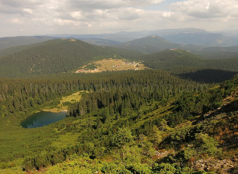
From here on, the Sebeș Valley deepens and Transalpina crosses a wild gorge. Some isolated cliffs stand out on steep and wooded slopes with pine and beech. Two geological reserves, “Masa Jidovului ” (The Jew’s Table) and “La Grumaji” (At the Napes) are located about 10 km south of Şugag. The valley gradually opens and on the left you can see the mirror of the Reservoir Tău-Bistra. The road meanders further along the Sebeș Valley in an easy climb, another 16 km, to the Oașa Lake Dam (located at 1,250 m). Oaşa Dam is a rest stop. From the dam you can watch one of the few panoramas to the lake as well as to the highest peak in Șureanu, the Pătru Peak-2,130 m.

You can find here a few kiosks with food and hand-crafted products. From here, the forest road leads to the Șureanu Ski Resort. The road is in good condition and accessible for any type of car. Nevertheless an unpaved road can create small problems, such as dust in dry periods or puddles after rains. The road follows the outline of the lake for about 7 km. At kilometre 5 there is a monk monastery, the Oaşa Monastery. Here, in the courtyard of the monastery, where life has a different rhythm, you can visit an old wooden church and a newer brick one.


Near the monastery there is a spur from where you have another perspective on the lake and the surrounding peaks. Also, it is here the first accessible place for those who want to launch their own kayak and want to cross the two arms of the lake that stretch across the Sălanele Valley and Sebeş Valley about 4-5 km.
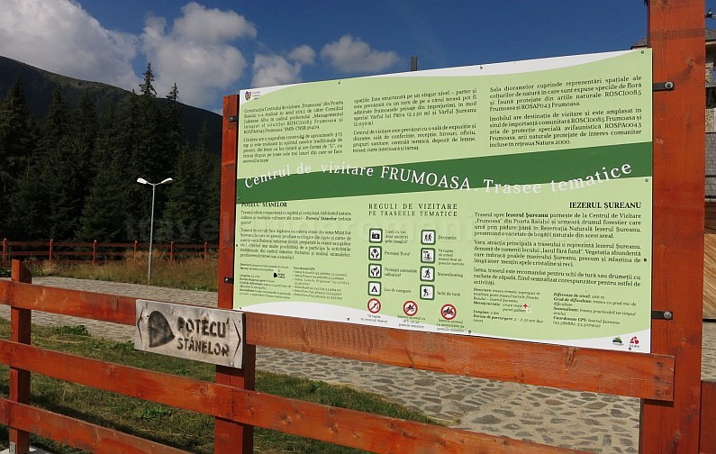
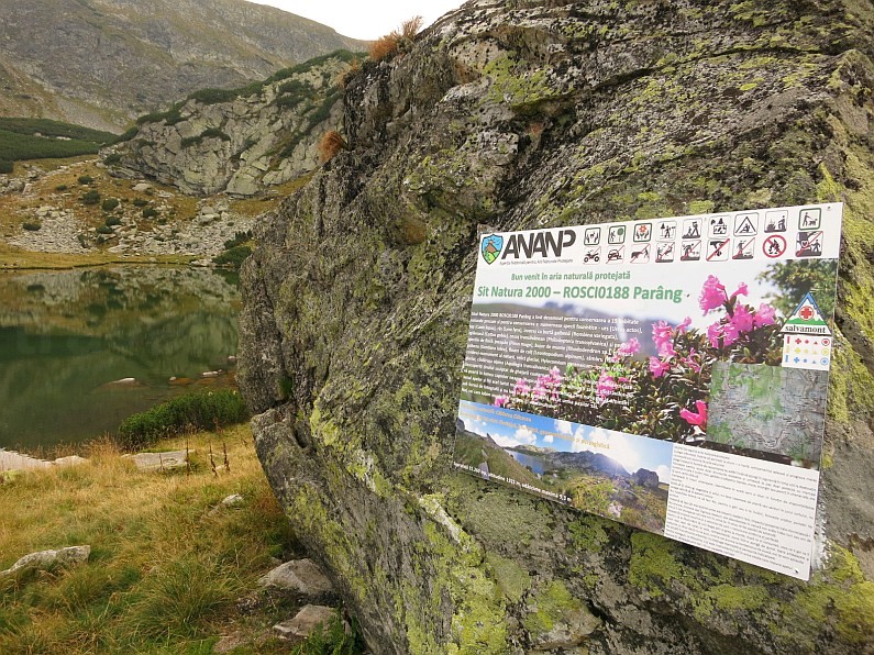
From the monastery, you go 11 km until Poiana Poarta Raiului (Heaven’s Gate), where you can enter the Visiting Center of the Natural Protected Areas Frumoasa.
In the same time, there are some accommodation units here. You can find other accommodation possibilities in Poiana Luncile Prigoanei, a holiday village, 5 km behind. From Poarta Raiului there are 2 km to the Șureanu Ski Resort. The road continues another 2 km to the Șureanu Military Lodge (1,734 m alt., does not accommodate tourists). The ski area consists of 10 slopes that start from the altitude of 1,650 m up to 2,010 m. From Poiana Raiului, from the road bend, a blue triangle tourist mark shortens the car road by more than 2 km. This trail arrives to the Șureanu Military Lodge in about 30 minutes. The mark bypasses the lodge and behind it you can admire one of the most beautiful glacial lakes in Romania.

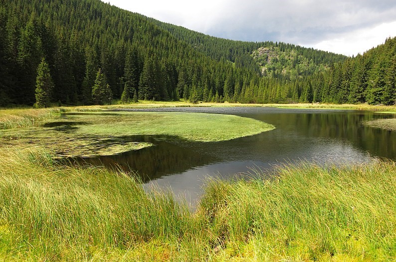
Lake Iezerul Șureanu (1,737 m alt.) is situated in the glacial cirque on the eastern slope of Sureanu Mountain, which rises above the lake at 2,059 m. The lake is surrounded by dwarf pines, junipers, fir trees and bilberries creating a fairy-tale atmosphere. The proximity of the road makes it accessible to families with children and there are some benches if you want to make a pause. For a top view of the lake as well as the vast panorama of the surrounding area (Cindrel, Lotrului, Vf. Lui Pătru, Poarta Raiului) we recommend the red triangle marked trail that comes off near the Șureanu cottage. When the marked trail comes out of the forest, leave it and follow the edge of the dwarf pines. You will find small paths that take you to wonderful lookout points over the lake.

Once you return to the Oaşa Dam, you continue on the Transalpina through the fir forest that offers few lookout points on Lake Oaşa. About 1 km from the dam you will pass by the Oaşa Lodge and huts. Near the lodge you can follow the red band ridge trail of the Cindrel Mountains. About 3 km from the Lake Oașa, near the Tărtărău Forester’s Lodge, the road from Frumoasei Valley, named Transcindrel, turns left.

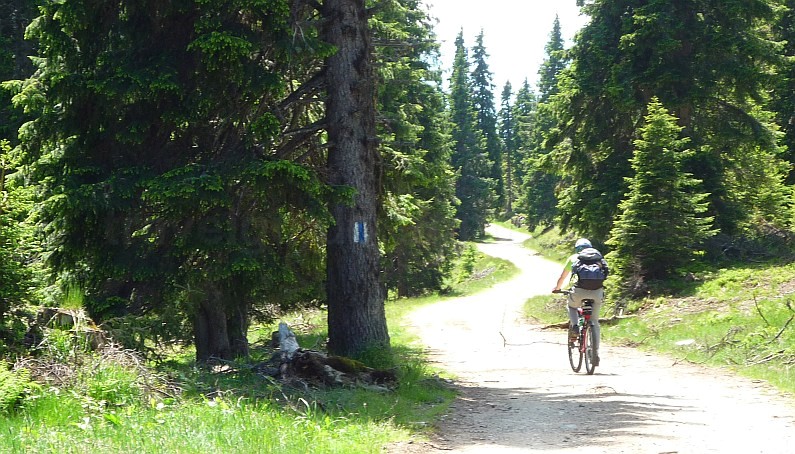
The unpaved road crosses the Sadului Valley over the Șteflești Saddle (1,725 m), the saddle that separates the Cindrel Mountains from the Lotrului Mountains. The road over the saddle is not accessible to small cars, but can be crossed by mountain bikes and is included in a more spectacular circuit on top of the Cindrel Mountains.

Further on, Transalpina climbs in wide bends, about 400 m elevation gain and for 9 km to the Tătărău Saddle, at 1,679 m. Here you find the watershed between the basins of the Sebeș and Lotru Rivers as well as the point where 3 massifs meet: Lotrului, Șureanu and Parâng. From here Transalpina descends on 6 km to 1,340 m, to Obârșia Lotrului. Obârșia Lotrului is a rest stop for tourists, with lodges, hostels, cottages, camping, kiosks with local products etc. Here Transalpina intersects the road DN 7A Petroșani-Voineasa-Brezoi (106 km). In winter, Obârșia Lotrului is accessible only on this road. From here, the Lotrului Valley heads east towards Vidra (Otter) Reservoir, 4km away. 3 km further and the road reaches the Vidra Ski Resort. The lake is surrounded by fir forests, from the 8 km-long road there are few places where you can admire the mirror of the reservoir. Vidra Reservoir feeds the Ciunget Hydroelectric Power Station, the second largest hydroelectric power station in Romania, after the one at the Iron Gates. Transalpina continues west through the wide valley of Lotru where Obârșia Lotrului Monastery is located. After about 1.5 km, the most spectacular part of Transalpina, the region Obârșia Lotrului – Rânca is separated from the road leading to Petroșani.
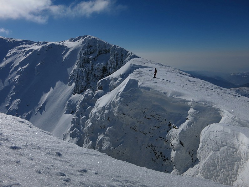
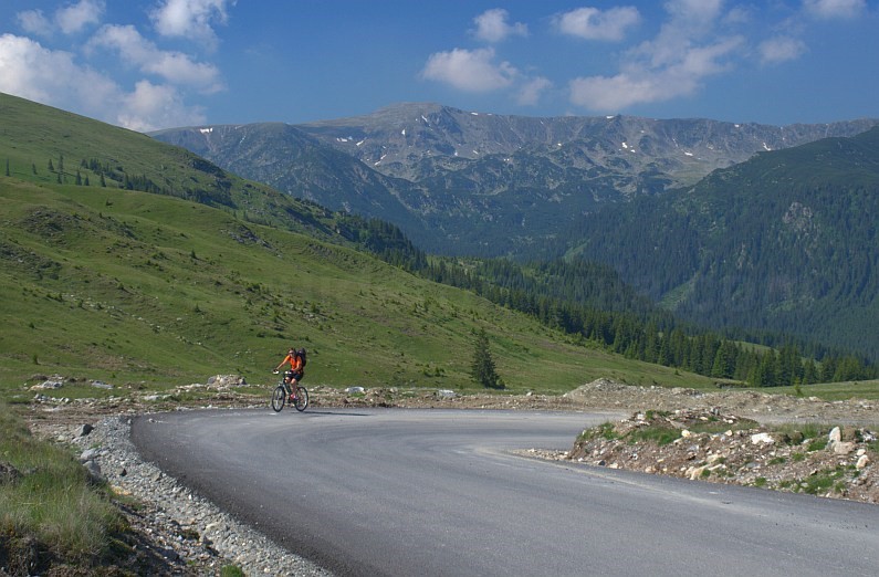
After crossing the Lotrului Valley, the road begins a real climb on the slope of Ștefanu Mountain in the Latoriței Mountains. In more than 15 tight curves, the road gains more than 300 m elevation gain, coming out into the alpine tundra. The sights begin to open on the right, towards the tops of the Parâng Mountains and the Câlcescu Lake Cirque guarded by the Setea Mare Peak (2,365 m).
At a tight bend of the road there is also a sheepfold, Stâna Ștefanu, a place of attraction on the Transalpina, offering tourists traditional dishes such as polenta with telemea (a traditional Romanian sheep cheese), sheep stew etc.
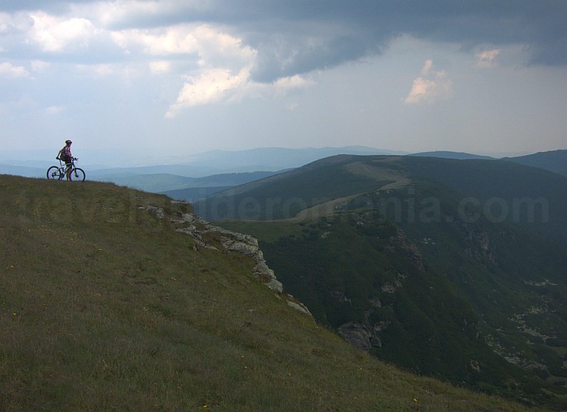
Another 2.5 km and Transalpina passes through the Ștefanu Saddle (1,915 m), where another spectacular road, the Strategic Road, breaks off to the left. It crosses the top of the Latoriței Mountains, from the Ștefanu Saddle to the area of Valea Maceșului, on a length of 45 km. The Strategic Road, unpaved along its entire length, is one of the most sought-after mountain-biking trails. If you feel like walking (about 12 km round trip), take the yellow cross marked trail, (unmarked at the beginning), up to Iezerul Latoriței. It is a glacial lake located at the lowest altitude in the Carpathians (1,530 m).

Transalpina continues to slightly climb, passing from the slope to the top that separates the Muntinul Cirque to the left, from the deep valley of Lotrului to the right. Here, on the plateau of the Muntinu Mountain, under the blue sky, panoramas open to the peaks and tops in all directions. You are in the heart of the mountains, where, most of the time, you will literally have your head in the clouds. On the left of the road there is a small glacial lake, Muntinul (1,980 m), visible from the road.


The rest stop with kiosks that offers mainly traditional food from different parts of the country invites you to make a new break.

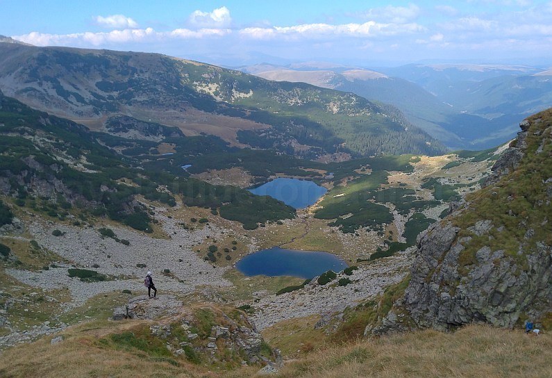
Tourists who venture on a longer trail, to the ridges and glacial lakes of the Parâng Mountains can also start from here, hiking on unmarked paths. The most visited is Lake Gâlcescu (Câlcescu), a protected area with glacial lakes, cliffs and rich vegetation, specific to mountain areas.
You should consider another 1.5 km (round trip) from the marked trail that starts from the Urdele Saddle. The advantages for those who leave the trail from here are: a more generous parking place and the fact that they start from a higher altitude (2,100 m compared to 2,040 m at the Urdele Saddle). From here up to Gâlcescu Lake you will hike for about 6-7 hours (round trip). The only more demanding part, due to the steep slope with scree, is the Hornul Lacurilor, which descends into the Gâlcescu Cirque, at the lakes Vidal, Pencu and Gâlcesu.

Those who dare to reach the top of Parângul Mare, the highest peak in Parâng -2,509 m, must reserve a full day for the trail, about 10-12 hours round trip. This trail is recommended for tourists with a very good physical condition and properly equipped.
From Muntinu, Transalpina still reserves us pleasant surprises. We find ourselves crossing the narrower ridge of the Muntinu Mountain, as if suspended between heaven and earth. Even if it is short, the portion will remain in our minds because of its spectacularity. The road descends into another rocky cirque, The Urdele Cirque.

At its lowest point you can drink water from a set up spring. From here the road climbs again. In the second bend of the road there is a small parking space and a tourist mark that indicates the direction to the top of Parang, to Gâlcescu Lake. From now on, 9 more tight curves to go in order to reach the highest altitude throughout Transalpina – 2,145 m.

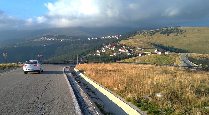
From here, from below the Urdele Peak (2,223 m), Transalpina begins its easy descent under the peaks of Dengheru (2,084 m) and Păpușa (2,136 m). Further on the descent is more accentuated up to the Rânca Resort. Rânca with its 6 ski slopes is more sought after in winter.
From Rânca, Transalpina descends on 18 km to Novaci, on a long ridge, through the deciduous forest.
– The INFOTRAPHIC Centre of the General Inspectorate of the Romanian Police informs population when the traffic is closed or resumed on the alpine section between Rânca, (Gorj County), and Obârșia Lotrului, (Vâlcea County) respectively from kilometre 34 +800 meters to 59+800 meters. Usually, higher than 2,000 meters, snow persists from November to May-June.
– on this section, traffic is allowed only between 8 a.m. and 8 p.m. for vehicles with a maximum authorised mass of less than 7.5 tons,
– maximum speed 30 km/h
– at the peak of the tourist season, the road is busy, especially on weekends.
In winter, the road sections of Șugag – Baraj Oașa and Novaci-Rânca are cleared of snow for those who want to ski on the slopes of the Șureanu and Rânca Ski Resorts. In winter you can reach Lotrului Obârșia on DN7A Brezoi-Voineasa-Vidra-Petroșani. For access from Petroşani it is recommended to find out if the snow is cleared.
Recommendations
The Transalpina road can be crossed both from north to south or in the opposite direction, depending on your preference. The road has 2 lanes, one on each direction. However, if you climb from the north, you will gradually climb, passing at first through an area with fir forests and then through the most spectacular area, crossing the Parâng Mountains. From the south, from Novaci, the road climbs to Rânca in only 19 km to the alpine gap, from 450 m to 1,600 m.
– take at least a full day for Transalpina if you want to visit some sights on the route.
– we recommend going through the section Săiște-Şugag instead of Sebeș-Şugag, the road is only 7 km longer but crosses the villages located on the peaks of Mărginimea Sibiului : Săiște, Tilișca, Rod, Poiana Sibiului, Jina.
– stop as often as you can either to admire the scenery or, at rest stops, to taste some local products.
– fuel up before entering the Transalpina, the only gas stations are at the exit of Novaci, respectively at the exit of Şugag, so, all along 100 km you will not find any gas station.
– at over 2,000 m even in August temperatures can drop to 0 degrees and the weather can change quickly. If it’s sunny at low altitude, the ridges can be surrounded by clouds. Be prepared with suitable clothes and raincoats if you decide to take a walk on the tops.
– on Transalpina, the GSM signal is not working from Şugag to Rânca area. In different areas, in Obârşia Lotrului and the Mutinu Plateau there is a GSM signal from Orange.
– only at Rânca you can find a Mountain Rescue Base;
– accommodation is to be found at Rânca, the resort located at the highest altitude in Romania – 1,650 m and at Obârșia Lotrului.
The Transalpina also attracts road cyclists.
The trail can be finished, depending on the training, in a day or two. Access is either from the south or from the north, as you wish. From Sebeș the departure is made starting from 250 m altitude and from Bengești from 300 m. However, if you decide to start from the south, at the beginning, you will continually climb, for about 40 km. Also, bear in mind that at altitudes, the weather is more stable in the morning. From the north, the hardest part, the Obârșia Lotrului – Rânca, starts after 87 km from the start, and after crossing the Tătărău Pass (1,679 m).
By train, the closest train station to the Transalpina is, coming from the north, Sebeș and from the south, Târgu Cărbunești, 16 km from Bengești.
Recommendations for cyclists: avoid as much as possible the peak season July-August and weekends, when there are too many cars.
