


 Canyon the only tourist canyon in the Fagaras Mountains")


 – Apuseni mountains")

 – deepest cave in Romania")


 Castle from Hunedoara")


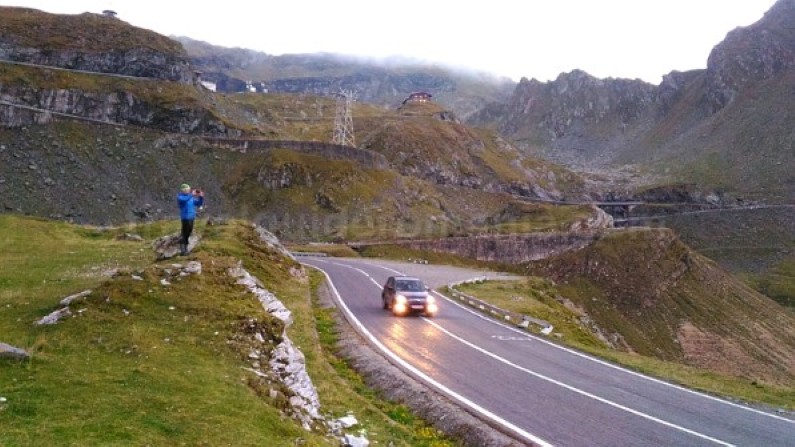
The Transfagarasan road is one of the most popular destinations in Romania for either drivers or cyclists.
Also known as National Road 7C, the Transfagarasan crosses Fagaras Mountains, the highest mountains in Romania. It’s linking the historical regions Muntenia to Transylvania.
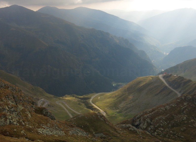
The Transfagarasan is 152 km long and goes up to a maximal altitude of 2042 meters, at Balea Lake. Because of that, it is the second highest mountain road in Romania, after the Transalpina (witch reaches up to 2145 m).
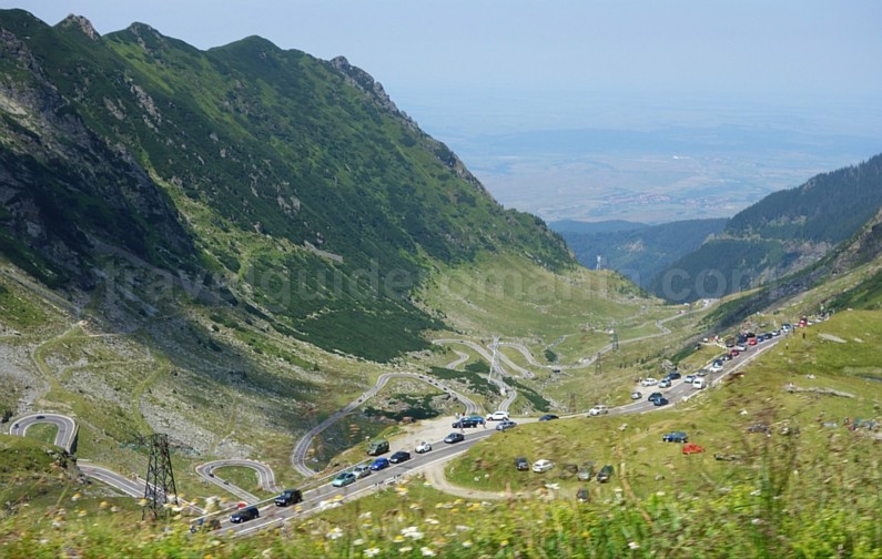
Transfagarasan road is linking the localities of Bascov, in the Arges County and Cartisoara in the Sibiu County, on the intersection with DN1. The most spectacular area is between the kilometre 104 (Piscu Negru-Arges County) and kilometre 131 (the Balea Cascada – Sibiu County) a total of 27 km.
Crossing the tourist area Piscul Negru – Balea Waterfall
- This area is closed 8 months per year (from November to June), due to avalanche risk, landslides or rock falling.
- During nigh time, between 9 p.m. – 7 a.m. the circulation is forbidden between Piscul Negru (km 104) and the Balea Waterfall Chalet (km 130.8).
- In summertime there are some days with temporary restrictions on certain areas, due to sport competitions or filming.
- During wintertime you can reach Balea Lake by taking the cable car from Balea Cascada.
- In peak tourist season try to avoid the time between 11 a.m. and 5 p.m. as the road is very crowded and there are long traffic jams.
- Coming from the southern part of the mountain towards the northern part you will cross the longest tunnel in the country. It has 884 m and goes into the Paltinu Mountain, linking the glacial cirque Balea to the Capra area. There are also four shorter tunnels, downriver the Vidraru Dam.
- The Transfagarasan crosses over 27 viaducts and 830 small bridges.
Data on the construction of the Transfagarasan
- The mountain area from the Vidraru Dam at Cârţişoara was built between 1970–1974 by military and civilian workers. The road is considered a strategic objective for Romania.
- Transfagarasan road was completely asphalted in 1980.
- The road took considerable efforts as workers were working all year round. 40 of the workers gave their lives for its construction.
You can either come from the north or the south, when crossing the Transfagarasan, it depends on you.
Tourist objectives coming from the South:
The road goes through the only town that the Transfagarasan crosses, Curtea de Arges. You can see here one of the most popular tourist attractions in Romania, the Monastery of Curtea de Arges. Built by Neagoe Basarab, the ruler at the time, at the beginning of the 16th century, the Monastery of Curtea de Arges is one of the architectural wonders of Romania.
Curtea de Arges monastery is also the sepulcher for the royal Romanian members. There are a lot of legends that relate to this monastery, the best known being the legend of Mesterul Manole (the master builder Manole) and his wife Ana.


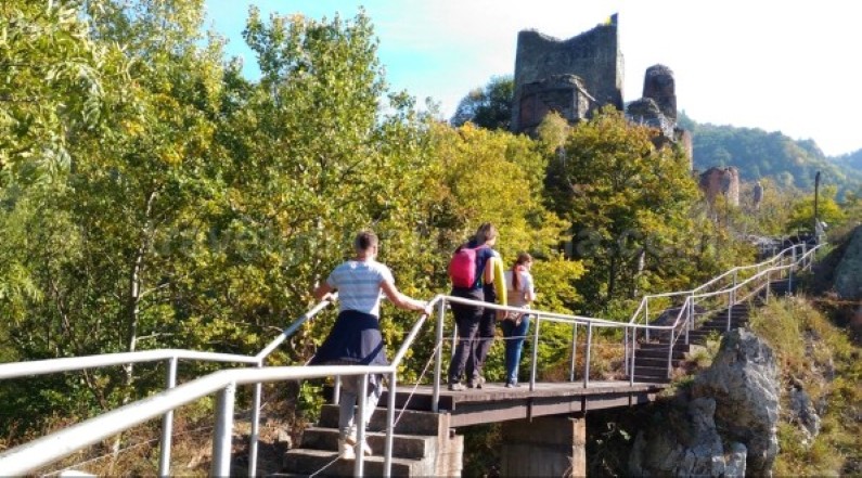
At 2 km from the last village crossed by the Transfagarasan, Capataneni, the road passes by the hydroelectric power plant Vidradu. Here is the place where the trails for the Poienari Citadel starts.


Sitting on the top of a rock, at 850 m, the ruins of the Poienari Citadel is accessible only by climbing 1480 stairs.
It is the real Citadel of Vlad Tepes – Vlad Dracul (known also by tourists as Dracula).
Poienari citadel was house of the ruler (voievode), the country treasury and as well a prison to boyars guilty of treason. It was built in two stages.
- The four storey square tower was used probably as an observation point and was built in the first half of the 14th century.
- The three semi-circular towers were built in the second half of the 15th century by Vlad Tepes.
Visiting the citadel by groups can be made , between 10 a.m. and 3 p.m. For the visiting hours search the site of the Argeș County Museum


From here, the next 5 kilometres, up to the Vidradu Dam, the road has a 200 m elevation gain crossing 4 small tunnels.
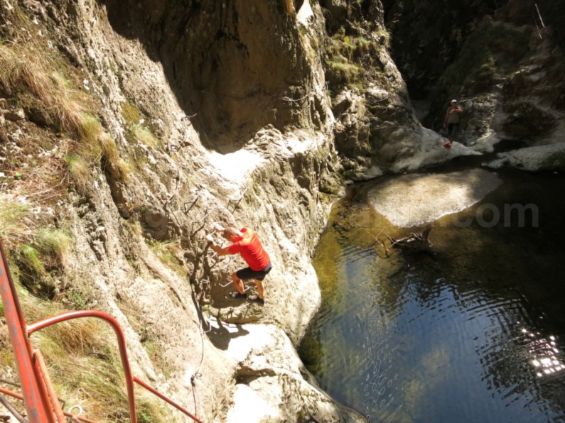
At around 3 km from the Poienari Citadel, in a tight curve, you will find the entrance to the Valea lui Stan Canyon. This canyon is one of the most spectaculars in Romania. This red point marked trail is provided with stairs, chains, cramps that make the trail a safe one.

Once reached on the Vidradu Dam, built in 1965, you will have an impressive sight towards the “interior sea”. Lake Vidradu is one of the biggest lakes in Romania.
You will surely feel nervous when looking downstream, from the dam, as the valley is 166 m lower.
Visiting the Vidraru Dam area:
- You can go on a boat ride or canoeing, kayaking or take the hydro bicycles.
- If you want to have a wider panorama you can climb up to the Statue of Electricity, near the dam. It is named also the Statue of Prometheus, having 10 m high. The access to the monument was reopened in 2018 after a period of repairing. There are periods when the access is forbidden because of the bears that frequently come into the area.


After seeing the dam you will travel 20 km of road along the lake, through the forest, in easy ups and downs. Only at the end of the lake, the road starts to go up constantly reaching the Chalet Capra, at 1585 m, in the alpine area.

From here, you have 9 more km to Balea Lake where you will first meet the impressive tops of the Fagaras Mountains.
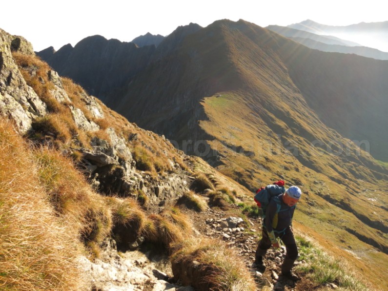
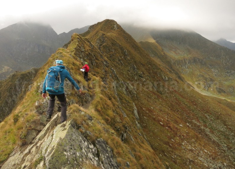
Some tourist trails that take several hours and start from the Transfagarasan will allow you to hike the Fagarasului Ridge, towards Lake Capra or Fereastra Zmeilor.
Before reaching to the Capra Mountain Rescue Chalet, on the right side of the road (in the climbing direction from the Piscul Negru), you can see Capra Waterfall.
This is actually the last waterfall of a series of 10 waterfalls that form the Capra Canyon.
To go through this canyon you need technical equipment like neoprene suit, ropes, carabiners. As well you need knowledge for vertical descent or a canyoning guide. Visiting period for this trip is quite short: August – beginning of September.

The tunnel road, electrically lighted and naturally ventilated, passes under the ridge of the Fagaras Mountains. It comes out near the Balea glacial lake , at the highest altitude of the Transfagarasan, 2042 m.
Balea Lake is the largest glacial lake in Fagaras, having a length of 360 m and a maximum depth of 11 m. The area around the lake was declared scientific reservation. On a small peninsula of the lake there is the Chalet Bâlea. Around the lake there are several chalets including the building of the Mountain Rescue Service. Also, a large number of booths with food and souvenirs are found here.
Being the most popular place on the Transfagarasan, it is also the most crowded. The lake is very frequented by tourists, creating even car traffic jams in the tunnel.

During winter, blocks of ice taken from Balea Lake are used to build the only ice hotel in Eastern Europe.
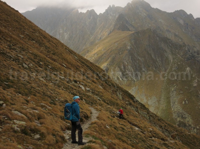
For those who want to do some hiking, Balea Lake is the mostly used starting point. First of all, from here you can reach the highest peaks in Romania, Moldoveanu Peak (2544 m) and the Negoiu Peak (2535 m).
You can reach Moldoveanu in a 1 or 2 days hiking trip.
- To do it in a 1 day trip you need about 13-14 hours round-trip. It can be done by those accustomed with hiking trails, properly equipped and with very good physical condition.
- If you want to enjoy the beautiful landscapes, you should do the trail in 2 days. The accommodation can be done either at Podragu hut, in a tent or at Vistea Refuge. To sleep here you need a warm sleeping bag and an isoprene.
Coming down from Balea Lake, there are still 13 km of spectacular road, up to the Balea Waterfall Chalet.
Balea Waterfall Chalet is located at an altitude of 1234 m. Its name is being linked to the waterfall that has about 60 m fall. It is less than an hour in the upstream of the Bâlea Valley.
From Balea Waterfall Chalet the cable car starts going up to Balea Lake (3.7 km long). It is the only way of access to Balea Lake during winter.
Descending from Balea Waterfall to the junction with DN1, near Cartisoara, there are still 22 km of the Transfagarasan.

The Transfagarasan is also looked for by road cyclists.
Useful tips for cyclists:
- By bike the Transfagarasan can be crossed in a day or two.
- Access is either from the south or from the north, according to preference. Similarly, from both ways the departure is at an altitude of about 400 km.
- The advantage starting in the north, is that you have a continuous climb for 35 km.
- In contrast, starting in the south (from Curtea de Arges) is that after 77 km, the final 9 km are the most difficult to climb. Also, these 9 km, from Capra hut to Balea lake are also the most beautiful.
- Keep in mind that at altitude, the weather is more stable in the morning.
By train the closest station to the Transfagarasan is:
- Carta village, from the north side, 3.5 km up to the Transfagarasan
- Curtea de Arges from the south side.
Recommendations for cyclists:
- avoid as much as possible the peak season July-August and the weekends, when there are many cars.
- the area is visited by bears so, do not camp in the woods near Vidraru Lake.

![]()